It was cold, and relatively hard, especially as one starts dreaming strange dreams above 4500m, but it was also beautiful beyond words or photographs.
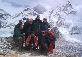
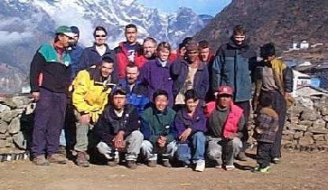
But let me start this trek story at the beginning. The trip was with the Australian Peregrine, 23 days in a group of 13, with Gokyo Lakes and Everest Base Camp as the main trekking goals. It all sounded easy enough - 3 to 6 hours of walking per day, sleeping in the luxury of local tea-houses, with safe food and excellent support from an experienced leader, Sherpas and porters. All we had to worry about were the views.
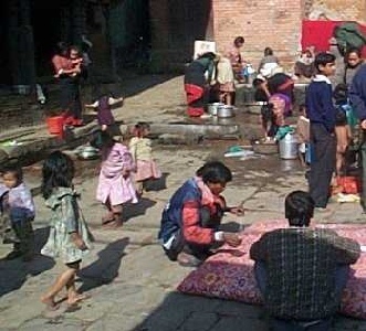
We met in Katmandu on the 24th of December, in an ex-palace hotel Shanker, and had a day to get over jet-lag, to explore the town, and to sort out the kit bags. The town itself is charming and exotic in an Indian sort of way, but calmer.
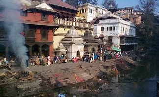
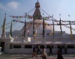
The beautiful Pashupatinath temple on the holy Bagmati river, with its Sardhus, cremations and crowds, and the huge Bodhnath Buddhist stupa, with the chanting monks and praying wheels, were amazing.
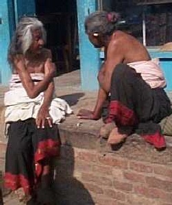
Still, the culture shock was due to something else: the streets. The cars horn interminably, but the cows in the roads don't seem to mind the noise, neither do the people and the chicken hanging off their bicycle's steering wheels.
The old women with bright shawls take sun baths in the dusty road shoulder, the kids are hanging off the roofs of buses, the barbers are using the traffic sign poles as their shops. The car pollution is atrocious, but midst all the chaos there is a harmony and tolerance uncommon to the disciplined streets of European towns.
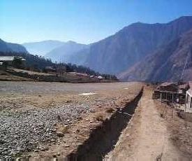
Our trek started on the 26. December, and the start was exciting enough. We flew to Lukla (2827m), the steep gravel airstrip built by Sir Edmund Hillary and the Sherpas in the mid '60s. The airplanes must land uphill (the top end of the strip is about 80 meters higher than the bottom) and reversely, they have to to take off at the end of a cliff. Our outbound flight was reasonably stable, but on our way back we learned just how unpleasant the wind currents can be in this area - the little 16-person airplane dived 5-7 meters about 20 times and the crash-alarm beeped equally many times.
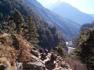
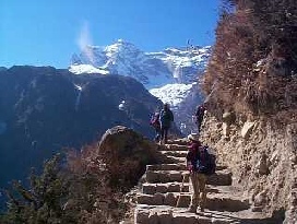
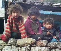
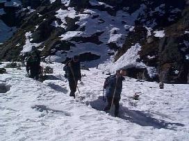
After this magnificent mountain flight we started the trek by following the Dudh Kosi river valley to Namche Bazaar. The trail to Gokyo climbed gradually up this valley, through small villages, birch and rhododendron forests, suspension bridges, yak-grazing settlements and overwhelming mountain views.
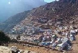
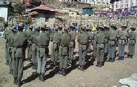
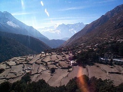
Namche alone was worth the climb. It's situated in a large, protected hollow and has magnificent surroundings (from now on, this goes without mentioning), a Tibetan market, German bakery, excellent book shops, and a good museum. We also celebrated the kings birthday with the local Gurkha soldiers in Namche.
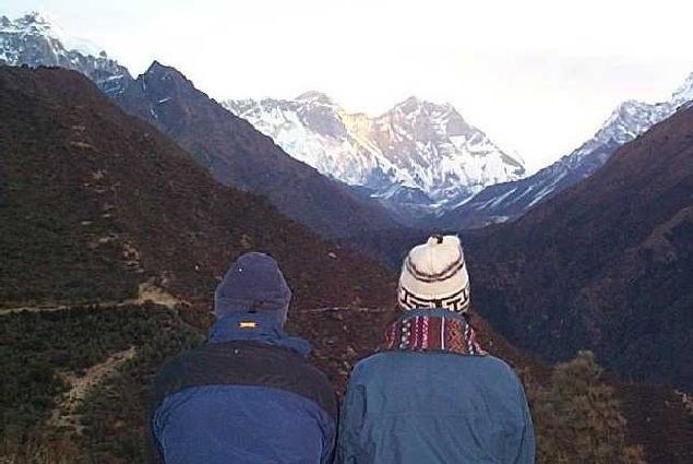
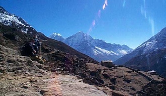
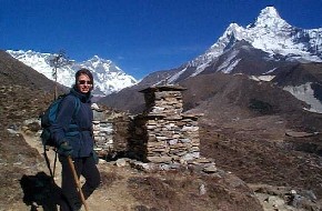
From a hill above Namche, we had the trek's first view on the giants Everest (8848m), Lhotse (8511m), Nuptse (7879m), Ama Dablam (6856m) and Taeweche (6542m). The sunrise on this hill was worth it's every cold second.
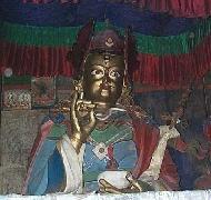
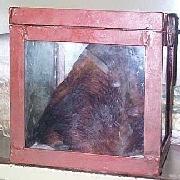
On the way from Namche to Gokyo we passed through several villages; the most impressive was Khunde. Besides it's infamous "yeti-scalp", it features a beautiful monastery and a Hillary-initiated high-school and hospital. The hospital is tiny, and very basic. At present a doctor from New Zealand works there for 2 years without any pay.
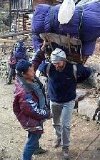
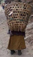
And if someone in the area gets sick, the "ambulance" (i.e someone else's back) carries them to the hospital in a straw basket for up to 7 days of hill walking (unless the patient is a rich tourist with an insurance that can fly him/her out with a helicopter in a few hours).
The health standards in the region have improved greatly since the introduction of the two hospitals, and the main health problems are now related to lung deseases due to the traditional open fireplaces in the kitchens.
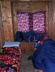
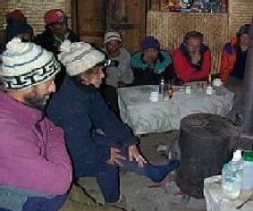
The beginning of the end of millennium caught us on the way, in Dole, at 7:15pm - we decided to follow east-Australian time, since none of us could stay awake past 8pm. Our sleeping bags were the only reasonably warm place at this point; also, the lighting is rather scarce in the high altitudes.
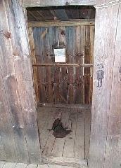
The heating is difficult, since it is forbidden to chop (live) wood and there's just not enough yak dung to keep all the tourists as warm as they'd like to be (in some of the lodges they fed the ovens with Alpine cushion plants that take hundreds of years to grow). Washing is also a big luxury in the winter.
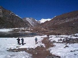
We arrived to Gokyo three days later, by this time mostly acclimatised and used to having -5 degrees Centigrade inside the sleeping quarters, and not worrying too much about showers or laundry any more. The lakes were making sounds: soft, deep vibrations, maybe the result of contracting ice or trapped air under it - anyway, the result was magical.
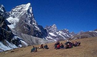
The climb to Gokyo peak is described as very easy in most guides, and I still wander who writes all those guides. Someone riding a yak, I guess, or fit beyond an average treker. (Out of our group of 13, only 6 people made it up there). The trail to the peak seemed innocent enough, and it _would_ be an easy walk if it wasn't at 5000m. But at that altitude, I puffed and sweated and puffed more that I can describe to get to the top.
Still, the view at the top made me forget all that in about 3 minutes. I felt just like G.L. Mallory describes in his quote: "We paused, in sheer astonishment. The sight of it banished every thought; we asked no questions and made no comment, but simply looked..."
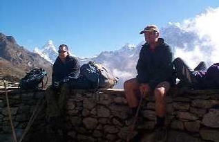
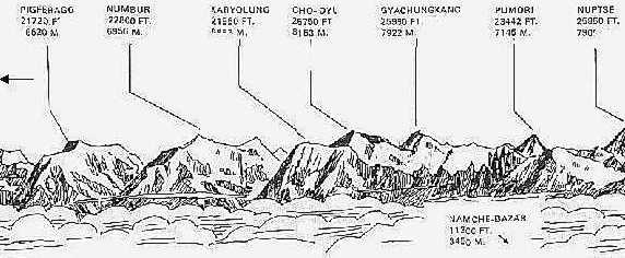
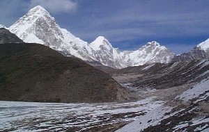
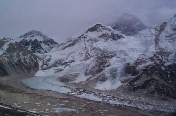
On our right we had Cho-Oyo (8153m), next to it Makalu (8475m), then Lhotse and Everest, under us he Ngozumpa Glacier, and countless other towering "lesser" peaks fill the horizons, including Gyachhung Kang (7922m), Cholatse (64440m), Taeweche (6542m), and Kangchung (6103m).
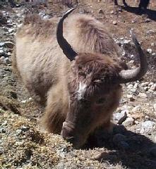
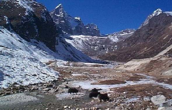
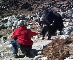
From here we traversed the below the Ngozumpa Glacier to the opposite side of the valley and descended to the village of Phortse. We saw more yaks, naks, snow cocks, pheasants, mountain goats, pretty much everything except the yetis.
From Porthse we followed the Imja valley over glacial moraines to the "summer settlement" of Dingboche. In the summer, during the monsoon season, a large number of yaks is brought here to graze on the valley pastures. In April, the Everest expeditions use Dingboche as the last point of comfort. In October, the most popular month for trekking, people walk in a queue through Dingboche.
But in December, we had it all for ourselves.
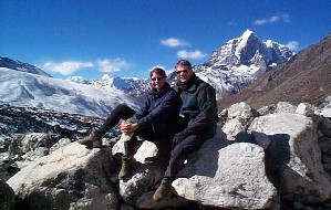
From Dingboche we had a one day trek to Lobuche, and from here we walked to Kala Patar, our highest peak, in a day. Kala Patar is 5545m high, but relative to it's surrounding it is a small black pile of rocks.
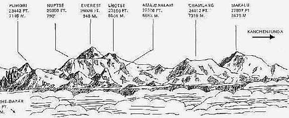
Once on top, we had the mountains of Khumbu laid out in front of us, the huge creaking glaciers below us. We were surrounded by towering Pumori, Nuptse, Changtse, Ama Dablam, Taeweche, Kantega and Everest Sagarmatha.
The view was quite different from the one we had at Gokyo peak - there we were beholding the highest mountain from a safe distance, here we were immersed in them.
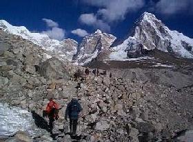
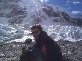
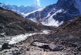
Next day was even more exciting - it was the climax of the trek for me. We walked to the Everest Base Camp on the Khumbu ice-fold. The walk was unexpectedly hard, since it looked very gradual from the top of Kala Patar.
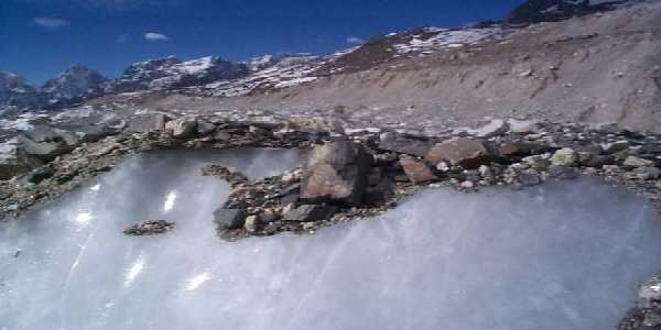
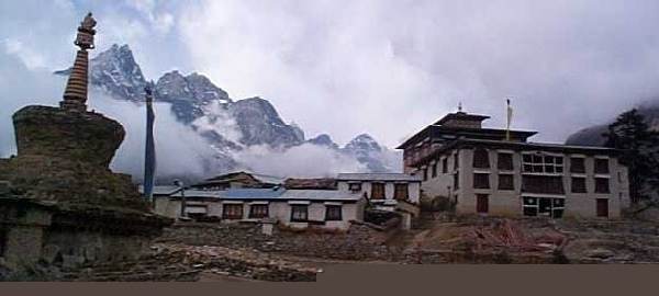
What we couldn't see from the top were the huge boulders on the ice that we had to climb over, all the slippery parts and all the unstable parts. From the Base Camp the record breaking time it takes 20 hours to the top of the world, more than 3000m higher up. From here it's all downhill, but only literally. We still have ahead of us a marvelous walk to Thangboche, a monastery located on a ridge in a stunningly beautiful location.
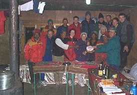
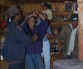
Then back through Namche to Lukla in two days, and a final party where our porters taught us a few things about dancing. On the trip they taught us a lot about hard work - I will never complain about heavy baggage again.
A few words about our "crew". It is possible to go on a trek like this with a single guide, and it can cost up to a third of what we payed. But my experience is that the money was very well spent. W e couldn't have been taken better care of, the organisation was very safe (food-wise and otherwise) and the friendliness and professionality of the people around us meant a lot in the harsh nature conditions none of us were used to.
As for the group, it was tolerant and positive, and after about two weeks of not having had a shower, having had small colds, sleeping too light in the altitude and being quite tired, it meant a world to have a joking, pleasant company, someone one could easily be with, sit by the stove with and share ones food with, rather than being with people who only wanted to climb down - we have met groups with such attitudes too.
As for what I've missed - well, after about 2 weeks, I wished for a shower, a steak, white sheets and some heat.
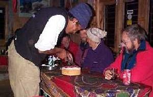
We talked about these things by the oven, and some members were very creative in their attempt to acquire meat for the group.
But only for moments at a time, until I reminded myself that I couldn't have the views, the lack of tourists and all the other things at the same time.
The beauty of the region outweighs the required effort many times, and I hope we can go back sometime again.

|